 |
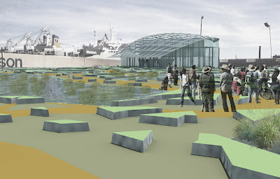
| view across remediation terrain |
 |
| terrain plan |
 |
| systematic process diagram |
The landscape of the Crane Cove site is a layered set of constructions and disturbances lead by a marine industrial logic. Requiring extensive remediation the site requires the treatment of a constructed terrain that frames and allows for the understanding of the natural and cultural process at play on the site. A parametric system is used to generate a functional landscape plan that responds to densities of habitation and voids of contamination. An intermediate landscape between path and void forms interstitial sites of engagement with the ground beneath.


